Best hikes in Hong Kong — comparing trails for every level
Hong Kong: Dragon's Back hike
What is the best hike in Hong Kong for first-timers?
Dragon's Back on Hong Kong Island is the best first hike — moderate difficulty, excellent ridge views, accessible by MTR and Bus 9, and finishable at Shek O beach. Allow a full day. For something shorter, the Victoria Peak circle walk (1 hour, flat) gives outstanding views with minimal effort.
Hong Kong’s hidden identity: one of Asia’s best hiking cities
Most visitors think of Hong Kong as a vertical city of glass towers and neon signs. Roughly 70% of Hong Kong’s land area is countryside — mountains, forests, reservoirs, and coastline protected as country parks. This makes it, improbably, one of the world’s great urban hiking destinations: a place where you can be on an exposed ridge above a UNESCO-listed geopark within 45 minutes of a skyscraper elevator.
The contrast is not just visual. The hiking culture here is genuine — local Hongkongers use the trail networks extensively, the paths are well-maintained, and the combination of terrain variety (coastal ridges, forested valleys, volcanic geology) within a small geographical area is exceptional.
This guide compares the main trails, ranks them by difficulty and visitor type, and gives the practical information to plan each one independently.
The main trails at a glance
| Trail | Difficulty | Distance | Time | Best for |
|---|---|---|---|---|
| Victoria Peak circuit | Easy | 3.5km | 1 hr | All levels, views without effort |
| Dragon’s Back | Moderate | 8.5km | 3.5 hrs | First-timers, ridge views, beach finish |
| Lion Rock | Moderate–Challenging | 7–8km | 3.5–4.5 hrs | Views over Kowloon, cultural significance |
| MacLehose Trail S1 | Moderate–Challenging | 10km | 4–5 hrs | Geopark, remote beaches |
| Lantau Trail S1–2 | Challenging | 15km+ | 6–8 hrs | Serious hikers, Lantau Peak (934m) |
| Sai Kung kayak | N/A (water) | Variable | 3–4 hrs | Sea caves, geopark columns, non-hikers |
Dragon’s Back — the flagship hike
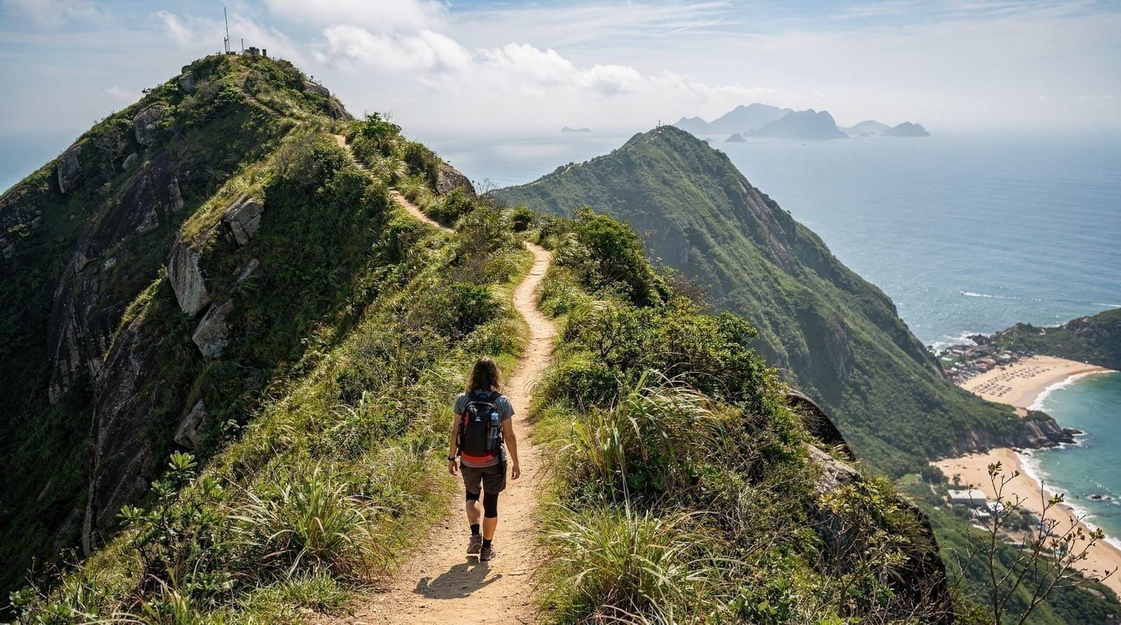
The Dragon’s Back ridge walk on the southeastern coast of Hong Kong Island is the best single recommendation for first-time visitors who want a proper hike. The 8.5km route from the Shek O Road trailhead to Shek O village provides continuous ridge views in both directions, a manageable difficulty level, and the option to finish at Shek O beach for swimming.
What makes it work: It is genuinely scenic from start to finish, not just at the summit. The route is well-signposted. The public transport access is simple (Bus 9 from Shau Kei Wan MTR). The beach finish at Shek O turns a morning hike into a full-day trip.
What to know: The ridge is fully exposed — sun protection and water are essential. In hot weather, start no later than 08:30. In wet weather the scramble sections become slippery.
Full details in the Dragon’s Back hike guide.
Dragon’s Back guided hikeLion Rock — the most culturally significant hike
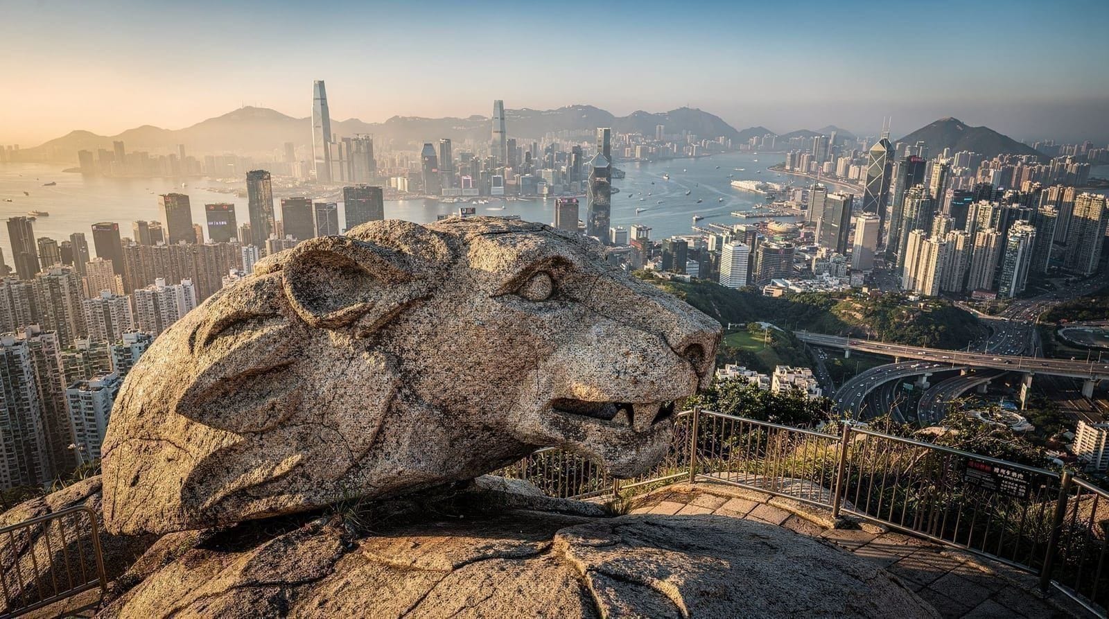
Lion Rock in Kowloon offers arguably the most panoramic urban views in Hong Kong — looking across the full Kowloon basin from 495m, with Victoria Harbour and Hong Kong Island to the south and the New Territories extending north. The trail from Wong Tai Sin MTR adds cultural depth (the mountain is central to Hong Kong identity in ways other peaks are not) and the Kowloon approach gives a different landscape from the Island trails.
What makes it work: The panorama from the summit is outstanding. The cultural context — Lion Rock Spirit, the protest banners, the working-class Kowloon neighbourhoods below — is specific and meaningful. The combination with Wong Tai Sin Temple creates a complete day.
What to know: The final scramble to the lion’s head is steep and requires hands-on rock. Do not attempt in wet weather. The trail is harder than Dragon’s Back on the uphill.
Full details in the Lion Rock hike guide.
Lion Rock ridge guided hike — 4 hoursVictoria Peak circuit — the easiest panorama in Hong Kong
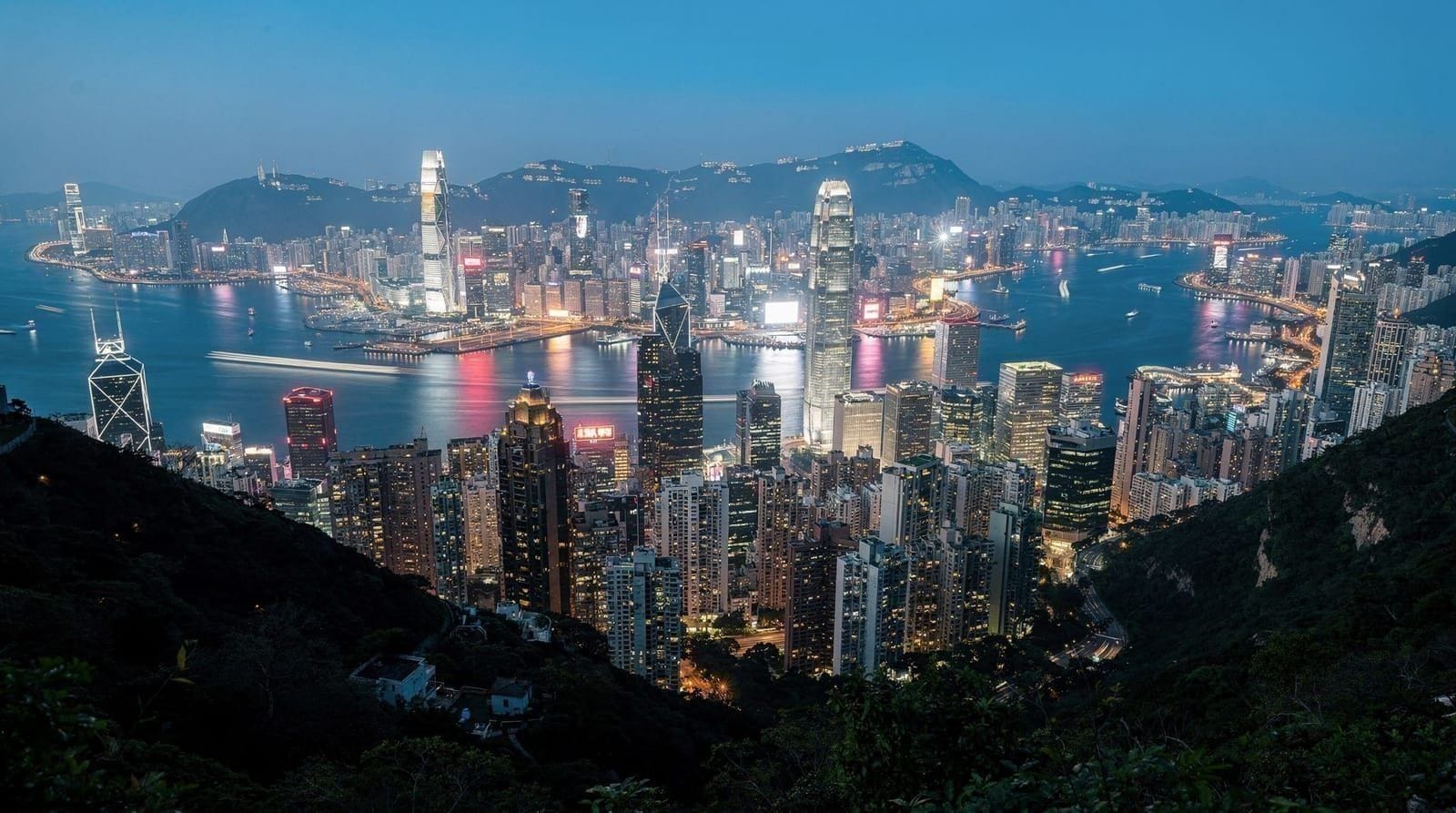
The Lugard Road and Harlech Road circular path at Victoria Peak provides outstanding harbour views with almost no effort — the path is flat, paved, and 3.5km long. It is not a hike in the athletic sense; it is a scenic walk. The comparison with the paid Sky Terrace (see thepeak.com.hk for current prices) is relevant: the path is free, the views are nearly identical, and the walking experience is better than standing on a viewing deck.
What makes it work: Fully accessible to all fitness levels. No equipment needed. Works as an evening walk (the path is lit until 24:00 and night views of the illuminated city are superb). Combines naturally with the Peak Tram experience.
What to know: The views depend entirely on visibility. Check the Hong Kong Observatory forecast — “good” visibility is needed for this to be worthwhile. In thick cloud or haze, the summit is completely obscured.
Full details in the Victoria Peak circle walk guide.
MacLehose Trail Section 1 — the geopark and remote beaches
The first section of the MacLehose Trail from Pak Tam Chung (accessible by bus from Sai Kung) to Long Ke Wan beach is the best introduction to Sai Kung’s extraordinary landscape. The 10km route passes through the Hong Kong UNESCO Global Geopark area, with views of the hexagonal volcanic column formations and a descent to one of Hong Kong’s most beautiful and remote beaches.
What makes it work: The combination of dramatic geological scenery (the High Island Reservoir East Dam area, the column formations visible from the ridge) and the Long Ke Wan beach finale. This section shows a completely different side of Hong Kong from the island trails.
What to know: Getting to the trailhead requires two bus connections from the city (Diamond Hill MTR + Bus 92 to Sai Kung + Bus 94 to Pak Tam Chung). Allow 1.5 hours each way for transport. The full section is 10km with some demanding uphill sections. Start early.
Full details in the Sai Kung Geopark guide.
Lantau Trail — for serious hikers
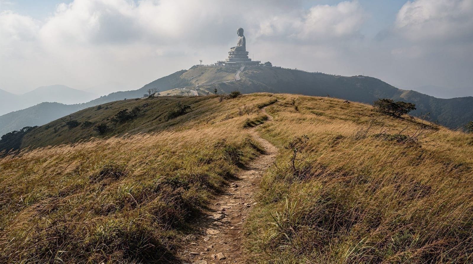
Lantau Peak (934m) is Hong Kong’s second highest peak and the centrepiece of the Lantau Trail’s most demanding section. The trail from Ngong Ping Plateau (accessible by cable car) to Lantau Peak summit and back is approximately 7–8km with 500m of elevation gain — one of Hong Kong’s genuinely challenging hikes.
The full Lantau Trail is 70km with 12 sections, taking 3–4 days for fit hikers. For a day visit, the Ngong Ping-to-Lantau Peak section (Sections 3–4) is the most accessible dramatic portion and can be combined with the Big Buddha visit on the Ngong Ping plateau.
Full details in the Lantau Trail guide.
Wilson Trail and Pat Sin Leng — for experienced hikers seeking solitude
The Wilson Trail traverses both Hong Kong Island and the New Territories over 78km. Sections 1–3 on Hong Kong Island (from Stanley to Quarry Bay, passing through Tai Tam Country Park) are often overlooked in favour of the Dragon’s Back and have a quality of solitude — dense woodland, reservoir views, and almost no tourist presence — that the more famous trails lack.
Pat Sin Leng (八仙嶺, “Eight Immortals Ridge”) in the northeastern New Territories is a 12km ridge walk at 639m with views toward the Hoi Ha Wan marine park and the Shenzhen border. Accessible from Fanling or Tai Po stations on the East Rail Line — typically 4–5 hours return and substantially less visited than the main Sai Kung and Kowloon trails.
For visitors who want the less-visited trails without the trailhead-logistics headache — awkward bus transfers, uncertain return timings — a private driver removes the friction entirely.
Hidden-gems hiking tour with private driverHikes for less experienced walkers
Not every visitor wants a 4–5 hour ridge scramble. A few genuinely rewarding, lower-effort routes are worth knowing about beyond the Victoria Peak circuit. The Bowen Road scenic walk above Wan Chai is a flat, shaded 1–1.5 hour stroll popular with local joggers, with occasional harbour glimpses through the trees and none of the exposure of the ridge trails.
Shing Mun Reservoir in the New Territories offers an easy 3–4km circuit around the reservoir under forest cover, cooler than most trails in summer and a reliable spot for macaque sightings at a respectful distance. Both are accessible without the early starts or full-day time commitment that Dragon’s Back or Lion Rock require, and both make sensible choices for a hot afternoon or a half-day gap in an itinerary.
Country park rules and practical tips
Water: No water available on most Hong Kong trails. Bring more than you think you need. 1.5–2 litres for a 3–4 hour hike is minimum; 2–2.5 litres in summer.
Typhoon signals: If Typhoon Signal 8 or higher is hoisted, all country parks officially close. Trail safety becomes uncertain before that — avoid exposed ridges at T3 or higher. Check the Hong Kong Observatory website (weather.gov.hk) or app before departing.
Trail markers: All official Hong Kong country park trails are marked with colour-coded distance posts (yellow and green, every 500m). The green post indicates the MacLehose Trail; yellow the Hong Kong Trail; red the Lantau Trail. Getting genuinely lost on marked trails is uncommon, though not impossible in poor visibility.
Maps: The Agriculture, Fisheries and Conservation Department (AFCD) publishes free country park maps downloadable at afcd.gov.hk. AllTrails and Wikiloc have community-generated GPS tracks for most major routes. Download offline maps before departure.
Wildlife: Rhesus macaques (monkeys) inhabit several hiking areas — particularly the MacLehose Trail sections near Shing Mun Reservoir and some Lantau trails. Do not feed them. Cobras and other venomous snakes are present but rarely encountered. The most common first-aid concern on Hong Kong trails is wasp/hornet encounters (particularly at ground level in summer). Watch where you step near undergrowth.
Gear shops: Mong Kok’s sporting district (Sai Yeung Choi Street and Tung Choi Street) has multiple outdoor and hiking equipment shops. Prices are reasonable compared to Western outdoor retailers. Trail shoes, hydration packs, and hiking poles are available at short notice.
The hiking forecast: checking conditions
For any hike in Hong Kong, check the following before departure:
- Hong Kong Observatory website (weather.gov.hk): Visibility forecast, precipitation probability, typhoon warnings
- The AQI (Air Quality Index): High pollution days limit the views from ridges — hillside views become meaningless in thick smog. HKAQIndex.gov.hk.
- AFCD Trail Conditions: Any closures due to maintenance or typhoon damage are posted at afcd.gov.hk
A clear winter morning with low AQI and “good” visibility listed on the Observatory website is the ideal condition for any Hong Kong ridge hike.
Building a hiking day around public transport timings
Because most Hong Kong trails start and end at different points, planning the return journey matters as much as planning the route itself. Dragon’s Back finishes at Shek O, where buses back to Shau Kei Wan MTR can queue heavily on weekend evenings — leaving Shek O by 5pm avoids the worst of it. Lion Rock’s Wong Tai Sin MTR start-and-end point makes it the simplest trail logistically, since you return to the same station. MacLehose Trail Section 1 requires the most planning: two bus legs each way, so building in 3 hours of transport on top of the 4–5 hour hike is realistic, not pessimistic. Checking bus frequency for your specific return leg before setting out saves a long wait at an unfamiliar rural bus stop after dark.
Fitting a hike into the rest of your trip
A hike works best when it replaces a day you would otherwise spend in malls and queues, not when it is squeezed between them. If you are still shaping your plan, the Hong Kong itinerary planning guide and the how many days in Hong Kong guide help you decide where a full hiking day fits. The Hong Kong islands itinerary pairs well with the Lantau trails, while the three-day itinerary leaves room for one early-morning ridge walk before the city wakes up.
Timing matters as much as the route. Read the best time to visit Hong Kong guide before locking in dates, and if you are travelling in the hot months, the Hong Kong in summer and typhoon season guides explain what to expect on exposed ridges. For the logistics of reaching the trailheads, the MTR guide and the Octopus card guide cover the trains and buses you will rely on.
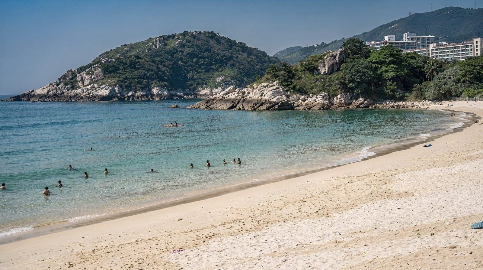
If you are travelling with children, the shorter, shaded routes are the sensible choice — see Hong Kong with kids for more ideas that suit smaller legs. And for a reward after the trail, Hong Kong’s beaches are a natural next stop, especially the Shek O finish of Dragon’s Back and the coast around Sai Kung.
Frequently asked questions about Best hikes in Hong Kong — comparing trails for every level
Do I need special equipment to hike in Hong Kong?
When is the best season for hiking in Hong Kong?
Are Hong Kong trails accessible by public transport?
What is the MacLehose Trail?
What is the Hong Kong Trail?
Is hiking in Hong Kong dangerous?
Can I hike year-round in Hong Kong?
Are there easy hikes in Hong Kong for less experienced walkers?
Do I need to book a guided hiking tour in Hong Kong?
Top experiences
Bookable activities with verified prices and instant confirmation on GetYourGuide.