Dragon's Back hike guide — Hong Kong's best ridge walk
Hong Kong: Dragon's Back hike
How hard is the Dragon's Back hike and how long does it take?
Dragon's Back is a moderate ridge hike of 8.5km, typically completed in 3–3.5 hours. The trail has some elevation gain (around 300m from the starting point at Shek O Road) but is well-marked and suitable for average fitness levels. Combine with Shek O beach for a full day. Start from the Shek O Road trailhead (Bus 9 from Shau Kei Wan MTR).
| Where | Shek O Road trailhead, Hong Kong Island (Bus 9 from Shau Kei Wan MTR) |
| Distance/time | 8.5km, around 3–3.5 hours walking |
| Difficulty | Moderate — some rock scrambling, no technical climbing |
| Cost | Free; public-transport fares only |
| Best time | November–March, weekday mornings before 09:00 |
Why Dragon’s Back is worth it
Dragon’s Back is consistently cited as Hong Kong’s most accessible ridge hike — and for once the reputation is accurate rather than inflated. The trail rewards walkers with continuous panoramic views across the southeastern corner of Hong Kong Island, the Lamma Channel, the outlying islands, and (on clear days) the open South China Sea. It is genuinely one of the best ridge hikes accessible by public transport from any world city.
The “dragon” in the name is the spine-like ridgeline visible from Shek O — successive rocky peaks that do suggest a resting creature when seen from below. The trail runs along this ridge, mostly above 200m with regular sections above 280m, giving views that expand as you walk. Unlike the Peak (which requires either a cable car or a road walk), Dragon’s Back feels like a proper mountain experience within 45 minutes of the city centre.
The Shek O combination makes the day: hike in the morning, arrive at the beach by early afternoon, swim, lunch in Shek O village, return to the city by late afternoon. This is a complete and satisfying day trip that requires no booking, no entrance fees, and costs only public-transport fares.
If this is your first visit, slot the hike into a longer plan rather than treating it as a stand-alone outing. The first-time Hong Kong guide helps you decide where a hiking day fits, and the Hong Kong 3-day itinerary shows how a clear-weather morning on the ridge can sit alongside city sightseeing. Travellers who like the idea of green space close to the skyline will also enjoy the Hong Kong Island ferries guide for a very different way of seeing the coast.
Getting to the trailhead
By bus from MTR (recommended):
- MTR Island Line to Shau Kei Wan station (eastern terminus), exit A3
- Bus 9 from Shau Kei Wan Bus Terminus toward Shek O (frequency: every 20–30 minutes on weekdays, more frequent on weekends)
- Alight at the To Tei Wan stop on Shek O Road — look for the Dragon’s Back trail signs. Journey time from Shau Kei Wan: approximately 20 minutes. Bus fare: see the operator’s website (Octopus card accepted).
The bus runs through the residential areas of Chai Wan and then climbs over the Shek O country park area — the road views before the trailhead are already interesting.
By taxi: From Shau Kei Wan MTR: approximately HK$60–80. From Central: HK$150–200. Taxis can drop at the trailhead directly. This is the faster option for groups or early starts.
Important: The trail begins in the other direction from Shek O village. The classic route goes trailhead → ridge → descent to Shek O. Do not reverse this without planning — the descent to Shek O is the natural finish point, and buses back to the city run regularly from Shek O village.
The route: step by step
Trailhead to the ridge (1–1.5 hours): The trail begins with a steady climb through secondary forest and some open grassland. The first kilometre involves consistent uphill on a wide path. The first significant viewpoint appears at approximately the 2km mark — south toward Shek O peninsula and the Cape D’Aguilar headland. The path narrows as you gain the ridge proper.
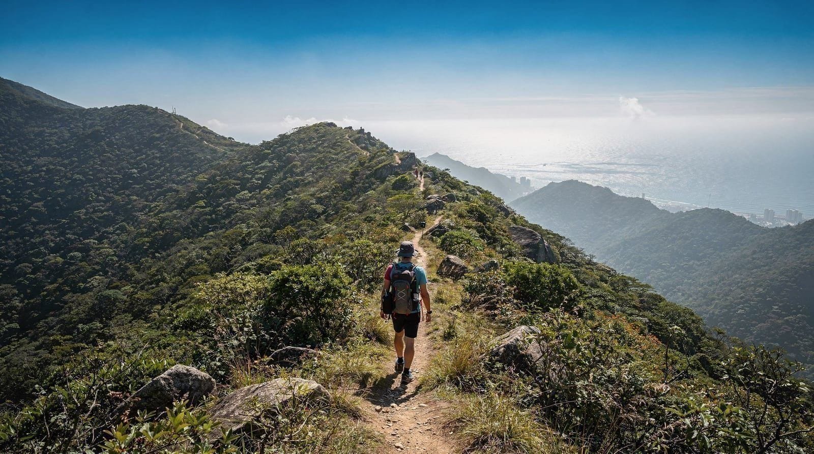
The ridge section (30–45 minutes): This is the heart of the hike. The path runs along the spine of the Dragon’s Back ridge, alternating between rock scrambles and packed-dirt sections. Views open on both sides: north toward the high-rises of eastern Hong Kong Island and Kowloon; south across the South China Sea. The summit of the Dragon’s Back is at approximately 284m. The atmosphere here on a clear morning — with a sea breeze, the city spread below to the north, and open ocean to the south — is one of the best in Hong Kong.
Descent to Shek O (45–60 minutes): The path descends from the ridge through the Big Wave Bay area (a well-known surfing beach, smaller and rockier than Shek O — worth a brief detour but Big Wave Bay itself is 15 minutes off the main path). Continue toward Shek O village.
Total distance: Approximately 8.5km from trailhead to Shek O village. Total time: 3–3.5 hours of walking at a moderate pace, not including breaks.
Shek O beach and village
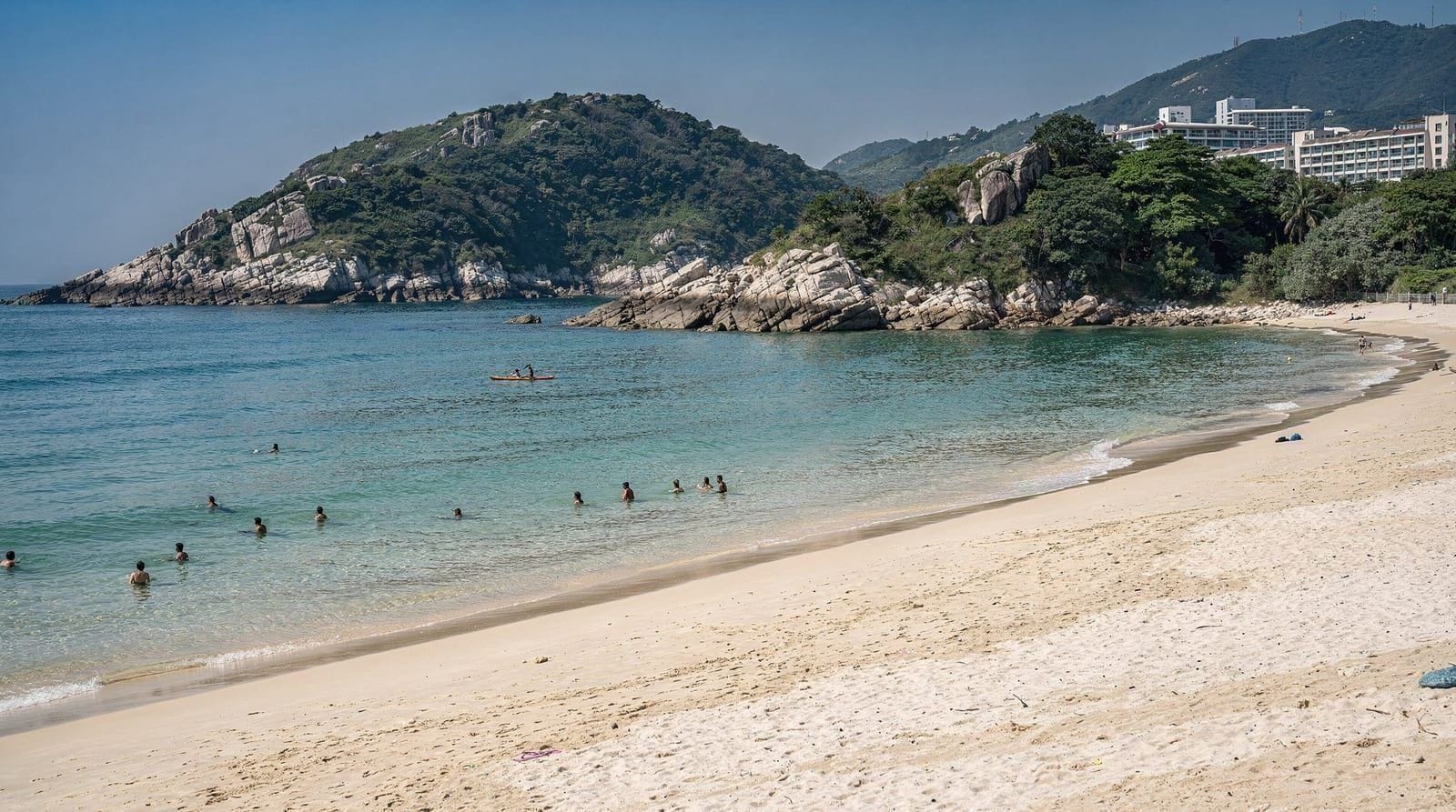
Shek O is one of Hong Kong Island’s better beaches — a proper arc of yellow sand approximately 200m long, with shark nets during the April–October swimming season, changing facilities, and a cluster of restaurants and shops in the village behind the beach.
Swimming: The water at Shek O is generally cleaner than Repulse Bay (which is on the western side of the island, facing more shipping traffic). Strong currents can occur around the headlands at either end of the beach — swim in the central section.
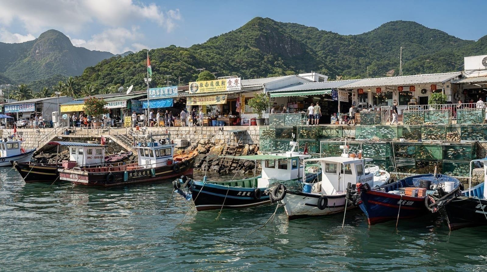
Shek O village: The village behind the beach has a small market area with seafood restaurants, convenience shops, and a cluster of basic cafes. Shek O Chinese Thai Seafood Restaurant (right at the beach entrance) is the most prominent and reliably busy — expect to wait on weekends. Seafood dishes HK$80–150. Black Sheep (café/bar at the edge of the village) is quieter and serves Western food. Both are fine; neither is outstanding.
Getting back from Shek O: Bus 9 runs from Shek O village back to Shau Kei Wan MTR — the same route in reverse. Buses run until approximately 22:00; more frequent in the late afternoon as beach-goers return. On summer weekends, queues at the Shek O bus stop can be 30–45 minutes — arriving at the stop by 16:00 avoids the worst of it.
Dragon’s Back guided hike with local guidePaying for the bus with an Octopus card keeps things simple on both legs of the trip; the Octopus card guide explains how it works, and the Hong Kong MTR guide covers the Island Line ride that gets you to Shau Kei Wan in the first place.
What to wear and bring
Footwear: Trail shoes or sturdy trainers with grip are appropriate. The path includes some loose rock and wet compacted earth sections that flip-flops handle badly. Dedicated hiking boots are comfortable but not essential for this trail.
Sun protection: The ridge is fully exposed. Sun cream, sunglasses, and a hat are essential from late March through October. The reflective effect from the surrounding sea is strong.
Water: As noted above, no water on the trail. Bring 1.5–2 litres per person from the start. The bus journey takes 20 minutes from the MTR — buy water at the Shau Kei Wan 7-Eleven before boarding.
Light layers (October–March): The ridge can be breezy and cooler than sea level. A light wind-proof layer is useful in winter.
Swimwear: If finishing at Shek O beach (strongly recommended from April–October), bring a swimsuit packed in your day bag.
The timing question: crowds vs weather
Dragon’s Back on a clear weekday morning between October and March is one of Hong Kong’s finest experiences. On a summer Sunday afternoon with heavy humidity, the same trail is sweaty, congested, and potentially dangerous if a typhoon warning rises while you are on the exposed ridge.
Check before going:
- Hong Kong Observatory (weather.gov.hk): Check visibility and rain probability
- Typhoon signal: If T1 or T3 signal is hoisted, reconsider. If T8 or higher, do not go — trails close and buses cease operation
- Visibility: “Good” (>10km) makes the views worth the effort; “Poor” (<5km) negates the primary draw of the ridge
Crowd mitigation: Starting at the trailhead by 08:00–09:00 on weekends puts you significantly ahead of the main crowd. By noon the ridge becomes busy; by 14:00 on summer weekends the bus queue at Shek O is unpleasant.
If you are still choosing your travel dates, the best time to visit Hong Kong guide sets out the seasons month by month, and the typhoon season guide explains what the warning signals mean in practice before you commit to an exposed ridge. Hiking in the heat is a different proposition, so Hong Kong in summer is worth a read if your trip falls in those months, while Hong Kong in winter describes the cooler conditions that suit this trail best.
Cape D’Aguilar extension
For experienced hikers who want more, the Cape D’Aguilar Marine Reserve at the southeastern tip of Hong Kong Island is accessible as an extension from Shek O (approximately 3km additional each way). Cape D’Aguilar has a lighthouse, dramatic rocky coastline, and a marine research station that operates public educational programmes. The coastline geology here — exposed rhyolite outcrops formed by ancient volcanic activity — is striking.
This extension adds 2–2.5 hours to the day and requires returning to Shek O (no through-route to the city). Only recommended for those who want a full day of walking and are comfortable with the additional distance.
For the context of Dragon’s Back within Hong Kong’s broader hiking scene, see the best hikes in Hong Kong guide which compares Dragon’s Back with Lion Rock, the Lantau Trail, and the Sai Kung routes.
Dragon’s Back vs Hong Kong’s other popular hikes
| Dragon’s Back | Lion Rock | Sai Kung Geopark | |
|---|---|---|---|
| Distance | 8.5km | 5–6km round trip | 6–12km depending on route |
| Difficulty | Moderate | Moderate–hard (steep final climb) | Easy–moderate |
| Views | Ridge, sea on both sides | Iconic skyline view over Kowloon | Volcanic rock formations, coast |
| Access | Bus from Shau Kei Wan MTR | Direct from Wong Tai Sin/Lok Fu MTR | Bus/taxi, less direct |
| Best combined with | Shek O beach | Nothing — dedicated hike | Boat tour, kayaking |
If Dragon’s Back sounds appealing but you want a shorter, more dramatic skyline payoff instead, see the Lion Rock hike guide. For coastal geology rather than a ridge walk, the Sai Kung Geopark guide is the alternative. The gentler Victoria Peak circle walk is a good option if Dragon’s Back sounds too strenuous.
Photography on Dragon’s Back
Dragon’s Back is one of Hong Kong’s most photographed hiking locations. The most distinctive compositions:
The ridge spine looking east or west: The undulating ridge with the sea on both sides in one image is the defining Dragon’s Back shot. Best light: early morning from the east (golden hour at the summit) or late afternoon from the west.
City-nature contrast: From specific points on the northern side of the ridge, the Kowloon and Hong Kong Island skylines are visible in the same frame as the natural hillside. This requires positioning on a clear day.
Shek O from above: Looking south from the ridge toward Shek O peninsula and beach, with the islands in the background. Often mist-free in winter.
Big Wave Bay: The surf beach below the Dragon’s Back, accessible via a side path, has good coastal photography from the rocks above the beach.
Hidden gems hiking tour with private driverIf the weather turns on the day you had planned for the hike, the rainy day itinerary is a sensible fallback, and the Hong Kong islands itinerary offers more coastal walking for another day. The nearby Stanley and Repulse Bay pages are useful if you want a second south-side stop after the beach.
Practical information
- MTR: Island Line to Shau Kei Wan (terminus), exit A3
- Bus: Bus 9 from Shau Kei Wan to Shek O Road/To Tei Wan stop (20 min)
- Distance: 8.5km (trailhead to Shek O village)
- Time: 3–3.5 hours walking + 1–2 hours at Shek O beach
- Difficulty: Moderate (some scrambling on ridge; nothing technical)
- Best season: October–March (November–February optimal)
- No water on trail: Bring 1.5–2 litres from start
- Return from Shek O: Bus 9 to Shau Kei Wan MTR (every 20–30 min)
Combining with other beaches
If Shek O is crowded on your visit, Big Wave Bay (a short detour off the main path, mentioned above) is a smaller, quieter alternative with decent swimming and a surf scene. For a broader look at Hong Kong Island’s beach options beyond the hike, see the Hong Kong beaches guide, which ranks Shek O against Repulse Bay, Stanley, and the outlying islands.
Frequently asked questions about Dragon's Back hike guide — Hong Kong's best ridge walk
How do I get to the Dragon's Back trailhead?
What is the Dragon's Back trail like?
Can I swim at Shek O beach after the hike?
Is Dragon's Back suitable for beginners?
What is the best time to hike Dragon's Back?
Is there water available on the trail?
Can I see the trail on the MTR Hiking Map?
How does Dragon's Back compare to Lion Rock?
Can I do Dragon's Back if I'm only moderately fit?
Top experiences
Bookable activities with verified prices and instant confirmation on GetYourGuide.